-
Stay Connected Stay Engaged
In the GIS and geospatial world staying connected and engaged with a professional network is not just an option; it’s a strategic imperative. Among the many such networks, the Manitoba GIS User Group (MGUG) is a great place for knowledge sharing and professional growth. In this blog post, we explore why it’s crucial to be actively involved in professional networks like MGUG and how it can benefit individuals and the industry.
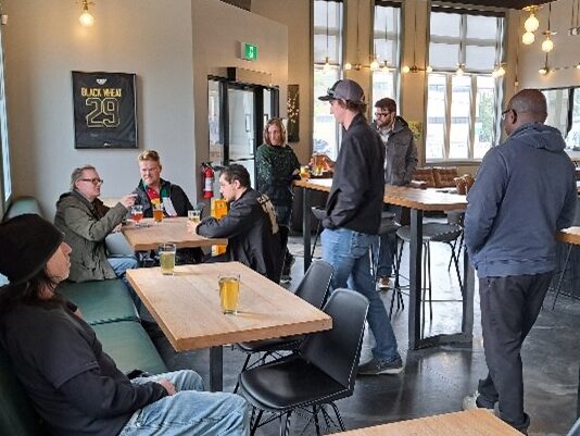
The first MGUG Westman Networking Night in many years marked a promising beginning, bringing together a small but enthusiastic group of professionals and students enthusiastic about GIS in Brandon at Black Wheat Brewing. With a few seasoned professionals and several eager students in attendance, the event offered a valuable opportunity for networking, sharing experiences, exchanging ideas, and catching up. While the turnout may have been modest, the energy and engagement among participants hopefully sets the stage for future gatherings that promise to foster even greater collaboration and camaraderie within our local GIS community. As we reflect on this first gathering, we are optimistic about the potential for growth and expansion, and eagerly anticipate the next chapter in our journey of building a vibrant and supportive professional network in the field of GIS. We’d really like to make this a bi-monthly event. With our hectic schedules and competing priorities, networking remains a cornerstone of professional growth and success. Whether it’s forging new connections, sharing insights, or discovering opportunities, investing in these relationships is essential for staying informed, inspired, and connected within the industry.
So, even when time is scarce, carving out moments for networking can yield long-term benefits, enriching both personal and professional development in the ever-evolving landscape of GIS.
Really… it’s a couple hours every couple of months!Why Network?
- Knowledge Sharing and Learning Opportunities
GIS and geospatial technology are rapidly evolving fields with new tools, techniques, and best practices emerging constantly. Engaging with a professional network like MGUG provides a platform for continuous learning and knowledge exchange. Through lunch and learns, conferences, and networking events, members can stay updated on the latest trends, advancements, and case studies in GIS applications. This exchange of ideas not only enhances individual skills but also contributes to the overall growth and innovation within the geospatial industry. - Career Development and Networking
Building a strong professional network is essential for career advancement in any industry, and GIS is no exception. MGUG offers networking opportunities where members can connect with professionals, experts, and potential employers in the field. Whether it’s attending networking events, participating in activities, or engaging with other GIS nerds, being part of MGUG can open doors to new career prospects, collaborations, and partnerships. Additionally, active involvement in the community can enhance visibility and credibility within the industry, potentially leading to career advancement and new opportunities. - Collaboration and Problem Solving
By taking part in MGUG, members have access to a diverse community of professionals from various sectors such as government, academia, private industry, and nonprofit organizations. This diverse pool of expertise enables collaborative problem-solving, knowledge transfer, and the sharing of best practices across different domains. Networking with MGUG can help foster synergy and creativity in your workplace. - Advocacy and Community Engagement
Professional networks like MGUG play a crucial role in advocating for the importance of GIS and geospatial technology in decision-making processes, policy development, and community development initiatives. By coming together as a collective voice, members can advocate for the adoption of spatial data infrastructure, promote data standards and interoperability, and raise awareness about the value of GIS in addressing challenges. MGUG contributes to building a more geospatially literate society and fostering greater appreciation for the role of GIS in shaping our world.
Being actively engaged with a professional network like MGUG offers numerous benefits for individuals and the geospatial industry. From learning and career development opportunities to collaboration, advocacy, and community engagement, MGUG provides a platform for professionals to connect, learn, and contribute to the advancement of GIS and geospatial technology. Whether you’re a seasoned GIS professional or just starting your career in the field, joining and participating in MGUG can be a rewarding experience that enriches both your personal and professional journey in the world of spatial data and analysis.
So, why wait? Take a step toward enhancing your GIS career and becoming part of a vibrant professional community by engaging with MGUG today!
-Steven Hills, May 5, 2024
- Knowledge Sharing and Learning Opportunities
-
The 143rd Annual General Meeting and Conference of the Association of Manitoba Land Surveyors (AMLS)
The 143rd Annual General Meeting and Conference of the Association of Manitoba Land Surveyors (AMLS) is scheduled for November 7th – 9th, 2023, in Winnipeg, Manitoba. In conjunction with the meeting, the Association hosts an Annual Luncheon, which will be held Wednesday, November 8th, 2023 at the Canad Inns Destination Centre Club Regent Casino Hotel, 1415 Regent Avenue West, Winnipeg, Manitoba.
Kindly RSVP by emailing executiveofficer@amls.ca on or before Thursday, November 2, 2023, to indicate if you or an alternate will be able to attend.
-
North American Datum Modernizations
Although some users continue to work in legacy reference systems, the current geometric reference system adopted by most jurisdictions in Canada and the U.S. is the North American Datum of 1983 (NAD83). It has evolved over the years and there have been many updates, but the fundamental system hasn’t changed for more than three decades.
That’s why the U.S. National Geodetic Survey is now modernizing its National Spatial Reference System (NSRS). They will replace NAD83 as their national geometric reference system with the North American Terrestrial Reference Frame of 2022 (NATRF2022). This update was originally planned for 2022 but has been delayed until 2025. This new system will be aligned to the new International Terrestrial Reference Frame of 2020 (ITRF2020) at epoch 2020.0 but will be fixed to the North American tectonic plate and will drift away from ITRF2020 as the tectonic plate moves about 2.5 cm/yr within the ITRF2020 frame.
Full article found here: